WoodPro: GIS Software-as-a-Service for Wood Procurement
Gary Mullaney April 8, 2020
At Sewall, we’ve been in the forest land mapping business for a very long time – since 1880 – most often for those who own and manage forest land.
In the last seven years, we have begun to serve wood procurement professionals with GIS tools and data.
Why?
Here’s the view of a WoodPro user:
“Woodpro has helped centralize and streamline the way our procurement department stores and accesses stumpage information by having a central place where foresters can go for everything they need: mapping, sale volume/price/location/bid result tracking, T&E and soils data, map exporting to GPS handhelds, and SFI wood basket information.
Through the county parcel data and tree canopy datasets in WoodPro we increased the efficiency of how we generate controlled stumpage leads. We can now query timber based on location, size, and merchantability and quickly generate mailing lists to targeted landowners.”
And, based on Sewall’s view of how our clients use WoodPro:
- The management of “vertical inventory” (whether company-purchased stumpage tracts or supplier-purchased stumpage tracts where the company has made commitments to the supplier) is a complex, spatial problem. Location, operability, distance, price, length of the contract all play a role in deciding how to schedule production of committed stumpage.
- Vertical inventory is not addressed well in most wood settlement / accounting systems.
- As the forest industry continues to expand in the U.S. South and more timberland is lost to low density development (the mini-ranch), wood procurement becomes increasingly competitive. Accurate information readily available to wood buyers provides a competitive advantage. As each tract is examined and captured in the company’s own spatial database (whether bought, lost to a competitor, or not sold), the level of market intelligence builds rapidly. A Sewall customer that has been using the system for seven years has captured location and market intelligence including competing bids on nearly 5,000 individual tracts of timber in their wood basin.
- Due to expansion and hiring in the 1970’s and 80’s, the procurement work force is now skewed heavily to people reaching retirement age. As they transition out, if there is no spatial market intelligence database they will take with them highly valuable local knowledge. Younger forestry graduates all have GIS training and assume that GIS tools will be available.
- GIS, like all information technology, has declined in real cost. Sewall is able to host, maintain, and support the WoodPro application for about one penny per ton of wood for larger mills.
- If a formal GIS solution is not adopted, this does not necessarily mean that the GIS cost is avoided. Instead, wood buyers come up with a variety of consumer-grade tools and websites to accomplish what they need. The cost, though somewhat hidden, may actually be higher, and none of the information is captured over time as a company resource.
- The cost of compliance with SFI (and other) Certification programs tends to rise over time as the programs become more demanding. Routinely capturing GIS and other data on stumpage sources can lower the cost and raise the level of compliance.
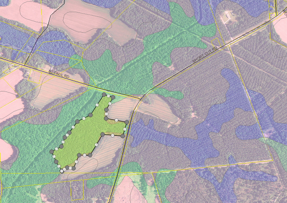
Recent aerial imagery, tax parcel boundaries (with owner information), county Soil Survey, and a sale area boundary being edited.
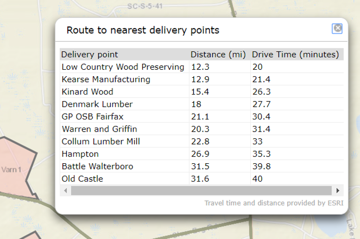
Route to the nearest delivery points, or to a particular delivery point.
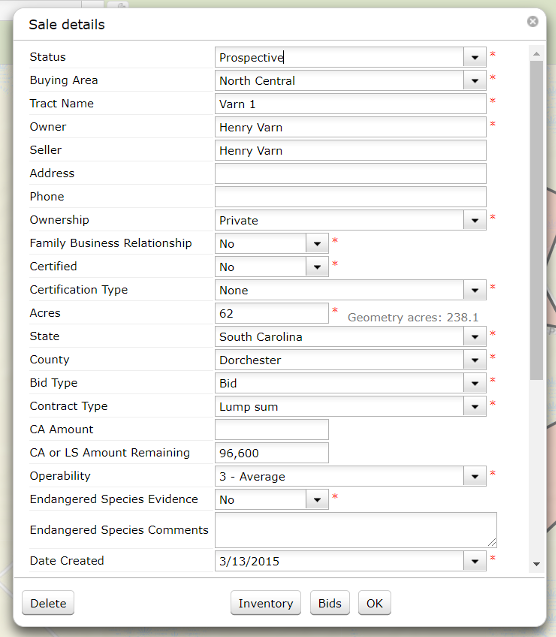
Customizable sale data, with detail inventory for each product and a place to record competitive bids.
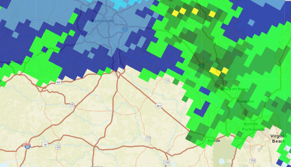
NOAA rainfall amounts recorded in the seven days prior to June 21, 2019. Also available for 1, 14, or 30 days.
DEMO
https://maps.sewall.com/woodpro/login.aspx
Log in as user: demo, password: demo