Remote Sensing for Agriculture
by Katie Moran, Remote Sensing Analyst
As discussed in our prior introductory blog, “What is Remote Sensing and What are its Applications?,” remote sensing provides opportunities for many industries to increase efficiencies and collect valuable insights that are not attainable from the ground. Agriculture is a prominent example of an industry that benefits from remote technologies–particularly drones and high-resolution satellite imagery.
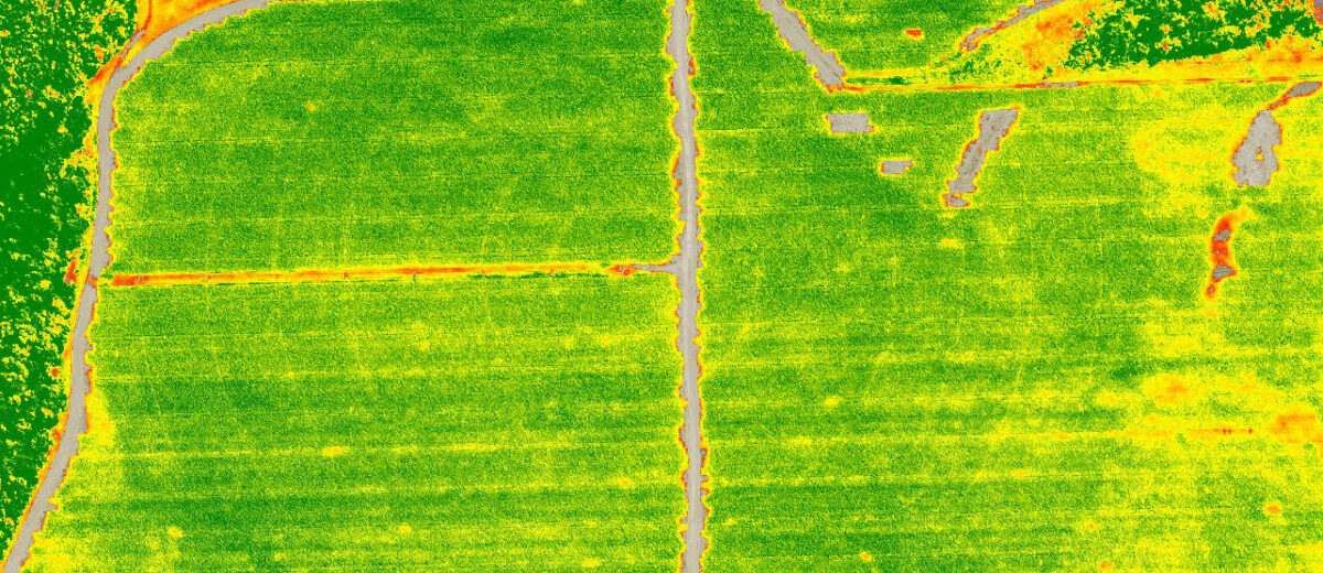
Some of the best-known uses of remote sensing in agriculture are to assess crop health by analyzing imagery for nutrient deficiencies, water stress, pests, and disease. While crop conditions can be apparent to the naked eye both on the ground and from the air, specialized remote sensors enable the collection of imagery that includes spectral bands beyond the range of visible colors (red, green, blue). Two such bands are near-infrared (NIR) and red-edge, which are invaluable for calculating vegetation indices to assess crop vigor. These bands and resulting indices can help identify plant stress before there are noticeable symptoms, allowing for early corrections and more efficient use of resources while also minimizing scouting and testing costs. This can be particularly helpful during drought years for monitoring crop water stress and efficiently irrigating, or flood years for managing fungal disease pressure from increased moisture.
There are numerous other remote sensing applications in agriculture. By collecting LiDAR or structure-from-motion (SfM) point clouds using drones, one can 3D model both ground and vegetation to create detailed terrain analyses and crop height/volume/biomass measurements for yield predictions. The very high pixel resolution offered by drone sensors also allows for weed mapping, as well as plant counts and germination tracking, so that germination failures can be replanted. Thanks to increasing advances in machine learning detection algorithms, remote sensing can even be used to predict when crops like broccoli are at the ideal harvest stage. Remote sensing is more accessible than ever with drones for time-sensitive and highly detailed imagery, in addition to increasingly affordable satellite imagery for extended monitoring of field conditions. With a changing climate and increased operating costs for farms, remote sensing can be a valuable tool for the early detection of stressed areas and production monitoring.