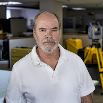
photo of james murray

James Murray

Project Manager Surveyor
james.murray@sewall.com

Jim has been a Maine Licensed Professional Land Surveyor since 1999 and has been in the Surveying business for 38 years. Jim joined the firm in 2002 as a Project Surveyor and has experience in all aspects of Land Surveying including cost estimation, scheduling, and supervising field operations, boundary analysis, deed research and analysis, and plat preparation. He is also involved in all stages of GPS operations including project planning, data collection, and post-processing.

Jim has provided research assistance, depositions and Expert Witness Testimony in boundary disputes and other legal issues.

Past projects have included numerous standard boundary surveys of parcels up to 7,500 acres, layout of telephone easements throughout Maine, and design and layout of subdivisions from 20 to 50 acres in size. Additionally, Mr. Murray has managed the survey component related to large commercial wind farms in Maine.

When not working, Mr. Murray spends way too much time fly fishing and photographing the world around him!

Education
Surveying core curriculum coursework, University of Maine
Coursework in Architectural Engineering, Greenville Technical College, Greenville, SC
Graduate in Architectural Drafting, Seible School of Drafting, Denver, CO

Year Joined Sewall
2002

Professional Affiliations & Licenses
Registered Professional Land Surveyor, Maine #2296

Experience

Sewall, 2002-Present
Project Surveyor

Representative Projects

Mack Point, Searsport, Maine. Boundary and Planimetric Survey (160 acres).  As project surveyor, completed a comprehensive boundary survey of the entire Mack Point terminal in Searsport, ME; the first to compile the numerous easements, leases, and ownership interests that affect the many coastal parcels that comprise this port facility.  Prepared a land title survey showing the current ownership and site conditions.

Burnham, Maine. Topographic and Hydrographic Survey of Burnham Dam (15 acres).  As project surveyor, conducted a topographic and hydrographic survey of the Burnham Dam and a portion of the Sebasticook River, downriver of the dam, for design of a fishway.

Dexter, Maine. Expert Witness Testimony.  Provided survey support and Expert Witness Testimony in a case involving the location of a Right of Way.

Murray Land Surveying Services, 1998-2002
Owner and Professional Land Surveyor

Civil Engineering Services, 1996-1998
Project Manager/Office Manager

Huntley Surveying and Engineering, 1989-1996
Project Manager/Office Manager

Collins Surveying, 1987-1989
Crew Chief/CAD Technician